Wildfires often capture our attention when raging flames threaten communities, but the danger doesn’t necessarily end when the main blaze is under control. Deep within scorched forests or peatlands, embers can smolder undetected for weeks—or even months—beneath the surface. These so-called “zombie fires” pose a unique threat: hidden from view, yet capable of flaring back to life under the right conditions. In recent years, drones with thermal cameras and sensors have emerged as indispensable allies in spotting these hidden hotspots, helping fire crews prevent reignition and safeguard both ecosystems and local communities.
Understanding Zombie Fires
The Hidden Threat
A “zombie fire” continues to burn under the soil long after visible flames have been extinguished. It can exist in organic-rich layers like peat, or under the roots of forest vegetation, where there is limited oxygen. Since they smolder slowly at low temperatures, zombie fires often escape notice when using standard detection methods such as ground patrols or spot infrared scans. Yet when conditions shift—like a drop in humidity or a sudden gust of wind—these subsurface embers can erupt into a full-blown wildfire, often catching responders by surprise.
Why They Persist

Zombie fires thrive in environments rich in carbon-based material. Drought-stressed forests, peat bogs, or areas with heavy leaf litter can provide ideal fuel for a slow, underground burn. As climate change prolongs dry seasons and increases temperatures, such conditions become more common, making these concealed fires a recurring problem. Detecting them before they escalate is critical for preventing further damage, but doing so requires specialized equipment that can sense heat below the ground’s surface.
Why Drones with Thermal Cameras and Sensors Excel at Locating Hidden Hotspots

Pinpoint Accuracy
Unlike the naked eye or even standard aerial photography, drones with thermal cameras and sensors can detect small variations in temperature—sometimes as precise as ±1°C. This enables them to map large stretches of scorched land quickly, identifying subtle heat signatures that could indicate a lingering subsurface fire. By reading infrared radiation, they generate real-time visuals of the terrain’s thermal profile, revealing areas that need immediate inspection or targeted action.
Safe, Extensive Coverage
Post-fire landscapes can be treacherous for ground crews. Fallen trees, unstable ash layers, and hidden sinkholes make manual inspection risky. Drones remove the need for firefighters to traverse hazardous terrain, scanning vast areas from the air in a fraction of the time. They are especially advantageous in rugged or remote terrains, including steep mountainsides or dense forests where traditional vehicle or foot patrols are impractical or dangerous.
Rapid Data Processing
Many drones with thermal cameras and sensors come equipped with onboard computing systems or can stream data to remote servers. This allows near-instantaneous analysis of thermal imagery. Instead of waiting on satellite data—which may only update once or twice a day—firefighters have current, actionable insights. They can mobilize ground teams or deploy fire-suppression tactics quickly, aiming to extinguish zombie fires before they regain strength.
Practical Advantages for Fire Management
Cost-Effectiveness
Deploying manned helicopters, extensive ground vehicles, and large sensor arrays can be expensive. In contrast, drones with thermal cameras and sensors typically have lower operating costs, require fewer personnel, and can be deployed rapidly, often multiple times a day. This economical approach allows firefighting agencies and environmental organizations to stretch budgets further while obtaining highly detailed information.
Crew Safety and Efficiency

With drones pinpointing the exact location of suspected hotspots, ground crews know precisely where to concentrate efforts. By minimizing guesswork and avoiding wasted time searching large areas, both the risk to personnel and overall resource consumption decrease. Once flagged by the drone’s data, crews can strategically move in with specialized tools or water lines to douse embers before they flare up.
Environmental Protection
Undetected zombie fires can emit substantial amounts of carbon dioxide and other harmful gases, contributing to climate change and air pollution. Peat fires, in particular, can burn for extended periods, releasing vast amounts of carbon. By quickly locating and extinguishing these subsurface fires, drones with thermal cameras and sensors help preserve critical habitats, reduce greenhouse gas emissions, and protect biodiversity in recovering forests.
Looking Ahead: The Future of Drone-Assisted Fire Detection
Autonomous Drone Swarms
The next frontier involves deploying multiple drones in coordinated “swarms.” This allows simultaneous monitoring over large landscapes, with each drone communicating with the others to divide scanning tasks and pool data. Swarms could cover a post-burn forest in a fraction of the time it takes a single drone, boosting early detection and lowering the odds of any hotspot remaining undetected.
Predictive Modeling
Paired with artificial intelligence, drone data can feed into predictive models that consider weather patterns, terrain features, and vegetation types. These models forecast where hotspots are most likely to occur or reemerge, further optimizing surveillance and resource allocation. As algorithms become more sophisticated, fire management agencies may receive predictive alerts days or even weeks before conditions are ripe for a major flare-up.
Multifunctional Payloads
Drones are highly adaptable. In addition to thermal imaging, they can be outfitted with other sensors—such as multispectral cameras or gas detectors—to assess a forest’s regeneration, measure hazardous emissions, or track wildlife recovery. This versatility transforms a single drone fleet into a multi-tool solution for diverse environmental and safety challenges.
Extended Wildfire Monitoring
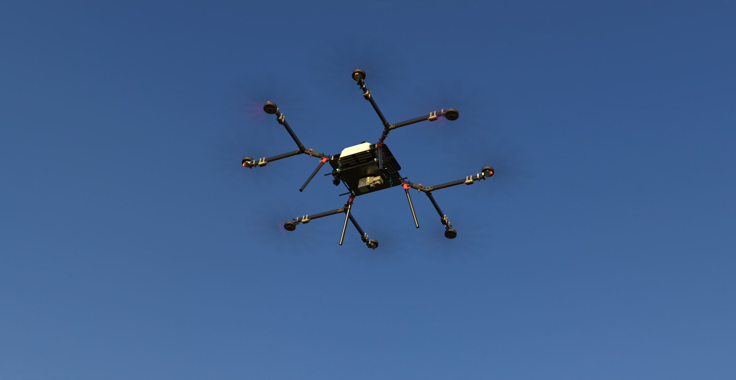
SkyScouter is a cutting-edge hybrid gas-powered drone designed for extended flight missions and Beyond Visual Line of Sight (BVLOS) operations. With a robust and efficient propulsion system, SkyScouter can fly for up to five hours without payload and for 60 minutes with a 9 kg payload, making it one of the most capable long-endurance drones in its class.
Key Features of SkyScouter:
- Hybrid Gas-Powered Engine: Reduces downtime with quick refueling and allows for longer missions compared to fully electric drones.
- BVLOS Capability: Enables long-range operations beyond the pilot’s line of sight, crucial for inspections, monitoring, and security.
- Multi-Sensor Payload Integration: Supports high-resolution cameras, LIDAR, infrared (thermal), and multispectral sensors.
- Autonomous Flight & Docking: Can autonomously take off, fly missions, land, and download data at its docking station.
- Weather Resilience: Designed to operate in challenging environments, including high winds and fluctuating temperatures.
- Secure Data Transfer: Mission data is automatically uploaded to a cloud or local server upon landing.
SkyScouter for Wildfire Detection and Hot Spot Monitoring

SkyScouter’s capabilities are perfectly suited for wildfire detection, offering:
- Early Detection: Equipped with thermal imaging cameras, it can spot fire hot spots quickly—even in dense smoke or after dark.
- Continuous Monitoring: Regular patrols over vulnerable forested areas help predict fire spread and inform proactive firefighting measures.
- High-Altitude Surveillance: Covers large areas efficiently with minimal refueling, making it an ideal choice for real-time wildfire tracking.
Flight Duration with a Thermal Camera
When fitted with a thermal camera, SkyScouter can fly for up to 3.5 hours, depending on payload weight, weather conditions, and flight altitude. This extended endurance provides comprehensive aerial surveillance of vast forested regions, enabling early identification of lingering zombie fires or newly forming hot spots.
By integrating drones like SkyScouter into wildfire management protocols, agencies and environmental organizations can detect and address covert fire threats more effectively, safeguarding forests, wildlife, and communities in a rapidly changing climate.
| Feature | SkyScouter Drone |
| Primary Use Case | Long-range industrial inspections, wildfire monitoring, border patrol |
| Max Flight Time | Up to 5 hours (hybrid fuel-electric) |
| Payload Capacity | 9 kg |
| Thermal Imaging Integration | Supports modular thermal sensors (e.g., FLIR) |
| Hot Spot Detection | Utilizes high-resolution thermal cameras with AI-assisted detection |
| Max Control Range | Up to 100 km |
| Weather/Environmental Resistance | Designed for extreme weather conditions, resistant to wind and precipitation |
| Positioning & Navigation | GPS-based with RTK support, AI-enhanced autonomous flight |
| Flight Safety & Redundancies | AI-assisted collision avoidance, failsafe return-to-home, multiple redundancies |
| Ease of Deployment | Quick-release props, tool-free assembly |
| Battery & Endurance | Hybrid gas-electric, enabling long endurance |
Comparison for Hot Spot Detection:
- SkyScouter Drone is ideal for large-scale, remote hot spot detection (e.g., wildfire monitoring, long-range infrastructure inspections) with its extended flight time and AI-powered thermal analysis.
- DJI Matrice 350 RTK is better suited for localized inspections, infrastructure monitoring, and real-time reporting with its advanced RTK positioning and integrated software ecosystem.